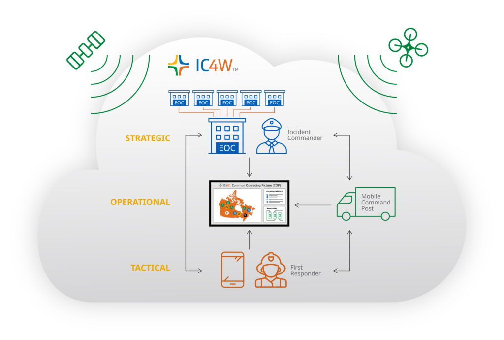
What is IC4W, and what does the name mean?
IC4W stands for Incident Command: Who? What? Where? When? It is a real-time emergency management software platform designed to help teams manage critical incidents and emergency operations with clarity and speed.
Does IC4W support Incident Command System (ICS) and Incident Management System (IMS) structures?
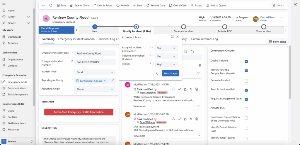
Yes. IC4W is flexibly configured to align with both the Incident Command System (ICS) and the Incident Management System (IMS), supporting structured response workflows right out of the box.
Can IC4W connect with Microsoft tools like Teams, Outlook, or SharePoint?
Yes. IC4W is built on Microsoft Dynamics 365 and Azure, offering native integration with the entire M365 ecosystem – Teams, Outlook, SharePoint, Power BI, and more – for notifications, document sharing, reporting, and real-time collaboration.
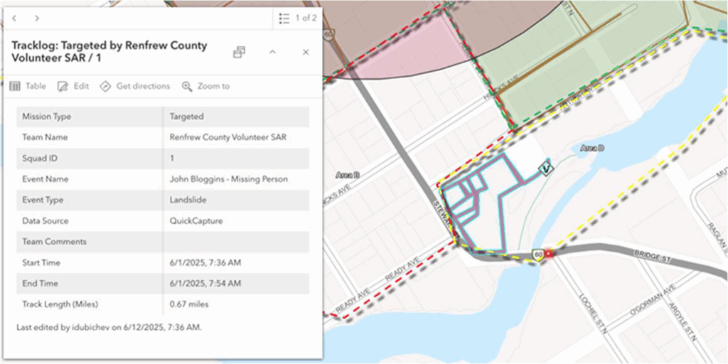
Does IC4W work with Esri tools like ArcGIS or Field Maps?
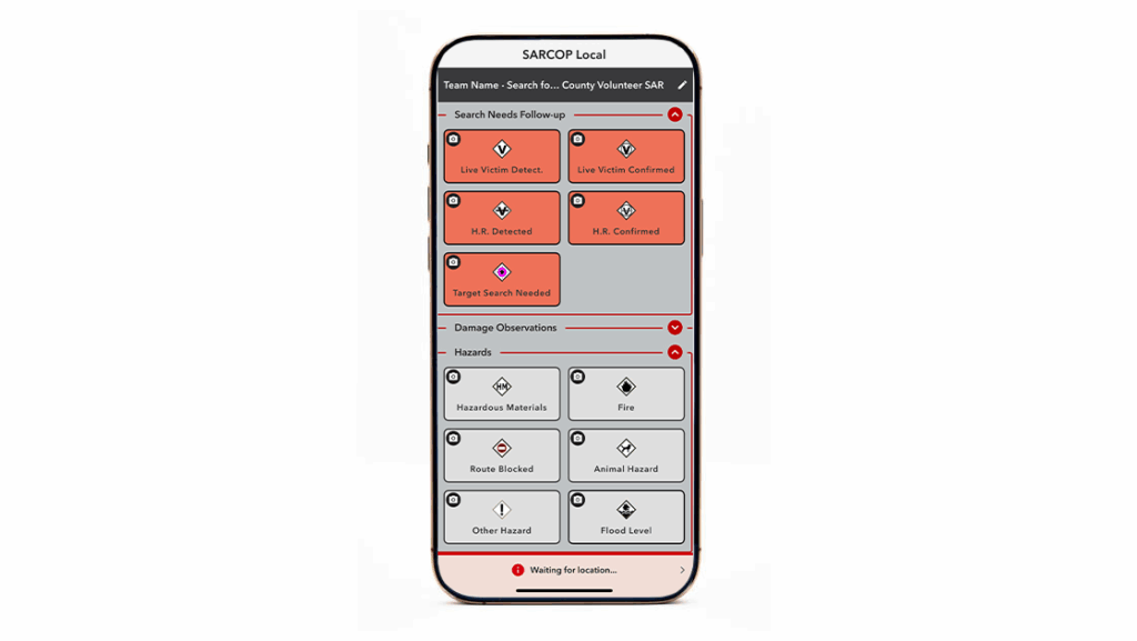
Yes. IC4W is equipped with a plug-and-play bi-directional synchronization engine that integrates directly with ArcGIS Online and ArcGIS Enterprise, supporting feature layers, dashboards, and field tools like Field Maps and QuickCapture.
Does IC4W use artificial intelligence (AI)?
Yes. IC4W provides optional AI-driven capabilities powered by Microsoft Azure AI and OpenAI services. These tools support rapid triage, incident pattern recognition, and actionable operational insights. AI features are entirely opt-in, and our team can work with you to demonstrate how these advanced capabilities can specifically enhance your incident management workflows.
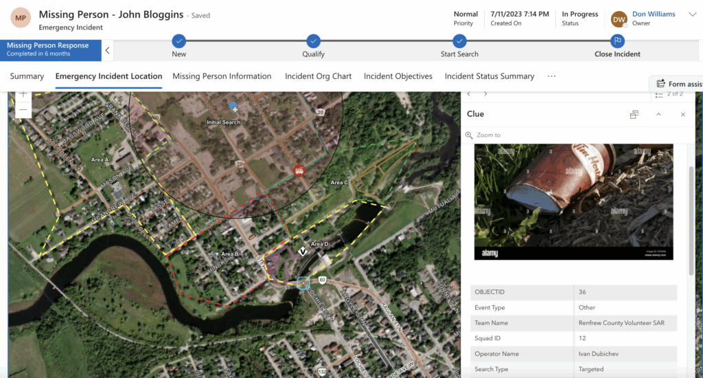
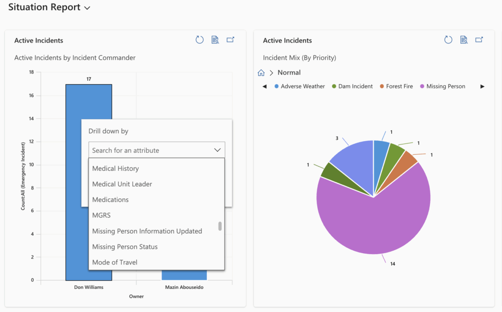
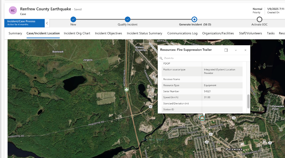
Does IC4W offer a real-time Common Operating Picture (CoP)?
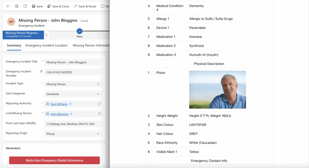
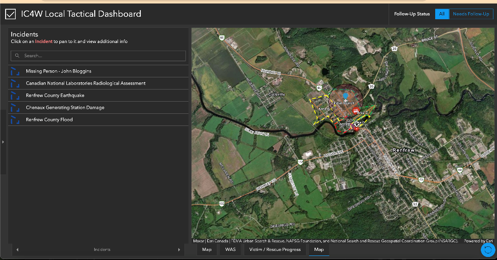
Yes. IC4W delivers a true real-time Common Operating Picture. It brings together live field data, interactive maps, incident statuses, and team communications in one place to keep everyone aligned.
Can IC4W be configured without writing code?
Yes. IC4W is fully configurable through easy-to-use admin tools. You can tailor forms, workflows, permissions, and views without writing any code. For more advanced scenarios, our team is here to help or train yours.
Where is IC4W hosted?
IC4W is hosted in Microsoft Azure data centers located in Quebec City, Canada and Toronto, Canada. These facilities follow Tier III or higher standards as defined by the Uptime Institute and are certified to host sensitive data for government, healthcare, and emergency management organizations. All data remains within Canadian borders to meet residency and sovereignty requirements.
Can I host IC4W in my own Microsoft Azure tenant?
Yes. IC4W can be deployed in your organization’s own Microsoft Azure tenant. This gives you full control over your data, security policies, and infrastructure while still benefiting from the full IC4W feature set.
How does IC4W fit with our existing emergency management tools?
IC4W connects directly to the Microsoft and Esri tools your teams already use. Field crews continue working with Esri mobile tools while incident commanders see all positions and updates in IC4W. Your existing SharePoint documents, Teams channels, and ArcGIS layers stay where they are.
Does CounterCrisis Tech provide 24/7 support and software maintenance?
Yes. We provide comprehensive support and training to ensure your team is fully equipped. Our Application Maintenance and Support (AMS) package includes 24/7/365 help desk access via phone and portal, plus regular system updates and ongoing support to keep IC4W running smoothly.
Still have questions?
If you have more inquiries or need personalized assistance, our team is here to help. We value your questions and strive to provide clear answers. Don’t hesitate to reach out for more information.